Scientists have successfully developed a novel method for seismic imaging that achieves real-time results without the need for invasive procedures.
The remote-sensing technique developed by KAUST researchers has successfully navigated its testing phase, demonstrating a proficiency in performing real-time seismic imaging of subsurface environments. The new approach is significantly more efficient and ecological than previously used strategies as it bypasses the time consuming and environmentally destructive process of drilling.
The new method utilises differently located sonic sources to permeate the ground with acoustic waves; by measuring in real-time how long it takes the waves to return to the receivers on the surface, the scientists are able to map subsurface environments accurately.
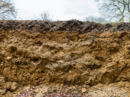
By examining how long it takes for the signal to pass through specific areas of the ground, the researchers are able to deduce from its hardness or porosity what the material is, with this also allowing them to identify pockets of subsurface water.
Gerard Schuster, a geophysicist from KAUST, said: “For a conventional seismic experiment, you need many different angular views to accurately estimate the properties of each substructure, which demands many hours to deploy and excite seismic sources over hundreds of different locations.”
Schuster and his team have dedicated the last two decades to finding an efficient seismic imaging solution to this geological problem, investigating the behaviour of cyclical patterns of acoustic waves – specifically how they lag or lead each other after penetrating through subsurface material. These alterations are known as phase differences; they can be inverted by seismic interferometry to proficiently attain high-resolution structural information without the need for an abundance of radio sources.
Schuster explained: “This approach requires much less effort. Taking the time differences between the phases allows you to answer questions about the hardness and softness of geology with just a few experiments instead of hundreds.”
To test the performance of their new seismic imaging technique, the researchers carried out a controlled time-lapse experiment, preparing multiple audio sources and receivers over a sand dune in the desert near the KAUST campus. The researchers infused the dune with 12 tonnes of water over multiple hours, taking nearly 100 interferometric measurements at each source location; this data was then transferred every two minutes into snapshots of subsurface water flow as it passed through the substructural layers below the ground.
“Our three-dimensional simulations of the experiments convinced us that what we saw wasn’t a false reading. The initial impact of these findings can be useful for environmental engineers who require rapid and inexpensive monitoring of the subsurface — for example, real-time imaging of leaky dams, or efficient Martian or lunar seismic surveys,” commented Schuster.