In 2022, four separate Earth science missions will be launched by NASA. They intend to investigate fundamental climate systems and processes. This means examining extreme storms, surface water, oceans and atmospheric dust.
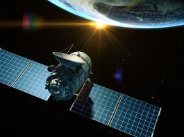
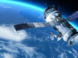
NASA already has an advantageous view of Earth from space, due to the fleet of Earth-observing satellites that provide high quality data on the planet’s interconnected environment. In order to gather specific data on other components, NASA intents to send more satellites into space in four separate Earth science missions.
Planned Earth science missions
The Earth science missions planned will provide Blackwell and his team with the opportunity to gain knowledge on four specific components:
- Time-Resolved Observations of Precipitation structure and storm Intensity with a Constellation of Smallsats (TROPICS) intended to gather improved and rapid measurements relating to tropical cyclones.
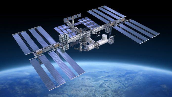
- Earth Surface Mineral Dust Source Investigation (EMIT) will trace the origin and composition of mineral dust that can affect climate, ecosystems, air quality, and human health with an imaging spectrometer aboard the International Space Station.
- National Oceanic and Atmospheric Administration (NOAA)’s Joint Polar Satellite System will help scientists to predict extreme weather conditions such as wildfires, floods, and volcano eruptions.
- Surface Water and Ocean Topography (SWOT) will evaluate the world’s oceans and their role in climate change, as well as monitor lakes, rivers and other bodies of water.
Tropical cyclones
The TROPICS Earth science mission intends to improve the observation quality of tropical cyclones. A total of six TROPICS satellites will work together to take microwave observations of a storm’s precipitation, temperature and humidity. It is expected that this data will help scientists understand the factors that drive tropical cyclone intensification, as well help to determine weather forecasting models.
The satellites that will be deployed in pairs, in three different orbits, are roughly the size of a loaf of bread, and will carry a miniaturised microwave radiometer instrument. In this Earth science mission, the small stature will allow the satellites to collectively observe the Earth’s surface more frequently than current weather satellites, greatly increasing the data available for more accurate weather forecasts.
This Earth science mission is expected to have deployed the required satellites by 31st July 2022. The launch will be managed by NASA’s launch services program, taking place at the Kennedy Space Center in Florida. Blackwell and his team are eager for this mission to take place, and all the possibilities that can emerge from the data they collect. “The coolest part of this program is its impact on helping society. These storms affect a lot of people. The higher frequency observations provided by TROPICS have the potential to support weather forecasting that may help people get to safety sooner,” said Blackwell.
Mineral dust
EMIT will be considering mineral dust on this Earth science mission, more specifically how wind kicks up dust from the Earth’s arid regions and transports the mineral particles around the world. This dust can influence the balance between the energy that comes towards the Earth from the Sun, the energy that the Earth reflects out into space (also known as radiative forcing), and as a result, the temperature of the planet’s surface and atmosphere.
Darker, iron-laden minerals tend to absorb energy. This leads to a rise in environmental temperature, whereas brighter, clay-containing particles scatter light in a way that leads to cooling. Thus, mineral dust can affect not only regional and global warming, but also the health of the people worldwide, and can trigger blooms of microscopic algae when deposited into the ocean. The goal of this earth science mission is to map where the dust originates and to estimate its composition so that scientists can better understand how it impacts the planet. In order to gain the required data, EMIT will use an instrument called an ‘imaging spectrometer’ that measures visible and infrared light that is reflected from surfaces below. The data collected can then reveal the distinct light-absorbing signatures of the minerals in the dust that helps to determine its composition.
This Earth science mission is targeted to launch in 2022. EMIT has a year long prime mission, and installation will take place on the International Space Station. “EMIT will close a gap in our knowledge about arid land regions of our planet and answer key questions about how mineral dust interacts with the Earth system,” said Dr Robert Green, EMIT principal investigator at NASA’s Jet Propulsion Laboratory in Southern California.
Extreme weather conditions
In order to forecast extreme storms in advance, specific data is required. Capturing the precise measurements of the temperature and moisture in our atmosphere, along with ocean surface temperatures, allows severe weather conditions to be predicted with enough notice to provide warning. It is the Joint Polar Satellite System (JPSS) satellites that provides this critical information to forecasters and first responders. These satellites also provide data about floods, wildfires, volcanoes, smog, dust storms and sea ice, all of which is vital knowledge for researchers on this Earth science mission.
“JPSS satellites are a vital component of the global backbone of numerical weather prediction,” said JPSS Program Science Adviser Dr Satya Kalluri. The JPSS satellites circle Earth from the North to the South Pole, taking data and images as they fly. As the planet rotates under these satellites, they observe every part of the planet at least twice a day, allowing critical Earth science data to be collected.
The Suomi-NPP (National Polar Orbiting Partnership) and NOAA-20 satellites are currently in orbit. The JPSS-2 satellite is targeted to launch in 2022 from Vandenberg Space Force Base in California on a United Launch Alliance Atlas V rocket. Three more satellites will launch in coming years, providing data well into the 2030s. NASA’s Launch Services Program, based at the agency’s Kennedy Space Center in Florida, will manage the launch service of this Earth science mission.
Oceans and their role in climate change
SWOT’s Earth science mission will investigate how much water Earth’s oceans, lakes and rivers contain. This will further scientist’s understanding into the impact of climate change on freshwater bodies, and the ocean’s ability to absorb excess heat and green house gases.
The satellite utilised for this Earth science mission will use the ka-band radar interferometer to measure the height of water. This measurement is taken from the interferometer bouncing radar pulses off the water’s surface, with the return signals being received with two different antennas at the same time. This technique allows scientists to receive an accurate measurement for the height of the water. This data is important for projects including, tracking regional shifts in sea level, monitoring changes in river flow and the amount of water stored in lakes, as well as determining how much freshwater is available to communities around the world.
The launch of the satellite intended for this Earth science mission will be managed by NASA’s Launch Services Program and is targeted for November 2022. SWOT will launch the satellite on a SpaceX Falcon 9 rocket from Vandenberg Space Force Base in California. “SWOT will address the ocean’s leading role in our changing weather and climate and the consequences on the availability of freshwater on land,” concluded Dr. Lee-Lueng Fu, SWOT project scientist at NASA’s Jet Propulsion Laboratory in Southern California.