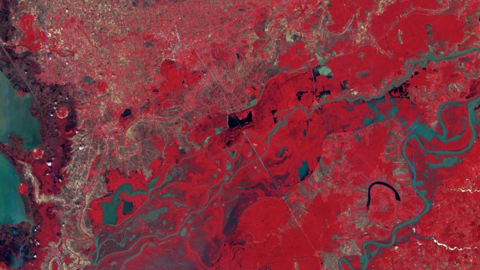
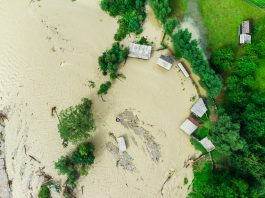
Dr Guy Schumann, the Founder and CEO of RSS-Hydro, details the fascinating technological evolution of flood mapping from space.
The Landsat series of satellites is undoubtedly one of the best known and longest Earth-observing satellite series still in operation today. The 50th-anniversary celebration was this July, with Its first satellite launched on July 23, 1972.
Since then, satellite observations have been successfully used for a variety of mapping and monitoring applications, with the greatest successes in the civil applications undoubtedly in the fields of land cover classification, Earth surface change monitoring, and in more recent years, disaster event mapping, with the Mississippi March and May 1973 floods being one of the first events mapped from space.1 The imaging of this flood from space clearly showed the potential of satellites for large area flood mapping and paved the way for much more innovation yet to come.
The timeline of flood mapping technology
About 15 years later, an all-weather capable synthetic aperture radar (SAR) onboard NASA’s Shuttle Challenger mapped the floods in Bangladesh in 1987 during a cyclone.2 Despite some technical problems with the mission,3 the immense advantages of this type of sensor to observe the Earth and its diverse processes during day and night as well as in all weather conditions were without a doubt demonstrated.
It took another 15 years for NASA researchers to demonstrate global flood monitoring and mapping capabilities with the Moderate Resolution Imaging Spectrometer (MODIS) onboard the Terra and Aqua satellites. Albeit hampered by frequent cloud cover, this has provided, to date, a quasi-operational daily mapping capability of impactful flood events at the global level.
Fortunately, this was not the only significant milestone that took place in the early 2000s in the context of global flood disaster mapping from space. In 1999, ESA and CNES initiated the International Charter for Space and Major Disasters, which became operational in November 2000, and now counts many satellite-operating agencies worldwide among its members. The Charter takes advantage of the many satellites and delivers many types of images during an event to support disaster management. The strength of the Charter lies in its ability to mobilise agencies globally and benefit from their satellites through a single access point that operates at no cost to the user.
Again about 15 years on since the milestone of the International Charter, it certainly was the launch of the European Commission’s Copernicus Programme and the ESA’s Sentinel missions that marked another historic milestone for Earth Observation. Its Emergency Management Service (EMS) provides several operational services during disasters, including flood mapping from satellite images, in particular from the Sentinel-1 SAR mission.
ESA’s growing Sentinel missions, alongside the constant increase in EO data from many other space agencies around the world in recent years, have led to a proliferation of free satellite data. In the current era of the new space economy, many companies building and operating commercial constellations of small satellites, in both the optical and radar spectra, are adding a massive volume of geospatial images to this data-rich EO landscape literally every hour. This big EO data world is enabling much faster and notable progress, particularly when combining online computing platforms with the recent advances made in machine learning (ML).
One of the most remarkable technological breakthroughs in the field of satellite-based flood mapping was achieved in 2019 when a team of young researchers in an ESA-sponsored ML challenge run by Frontier Development Lab (FDL) demonstrated the possibility of an onboard ML-based flood mapping algorithm,4 which was successfully tested in orbit within a record amount of time of just under a year later on the experimental mission “Wild Ride” launched by D-Orbit.5
The future of Earth Observation
It is clear that pushing innovation leads to technological advances that enable breakthroughs like the ones described in this article. For flooding and EO, an exciting future lies ahead, with many new groundbreaking developments still to come, enabled by advances in machine learning coupled with ever-growing computing power and many more satellite missions delivering enormous amounts of insightful EO images.
In the very near future, several constellations of satellites carrying different sensor types could be equipped with self-learning, evolutionary processing models that process acquired image data into actionable information and deliver it to the right person or team on the ground within minutes using geostationary satellites as data relay systems. Such constellations of “smart” satellites could also communicate with each other and exchange relevant information in order to optimise tasking for the next image acquisition over a location impacted by a flood disaster.
References
1. Deutsch, M. and Ruggles, F. (1974), OPTICAL DATA PROCESSING AND PROJECTED APPLICATIONS OF THE ERTS-1 IMAGERY COVERING THE 1973 MISSISSIPPI RIVER VALLEY FLOODS. JAWRA Journal of the American Water Resources Association, 10: 1023-1039. https://doi.org/10.1111/j.1752-1688.1974.tb00622.x
2. M. L. Imhoff, C. Vermillion, M. H. Story, A. M. Choudhury, A. Gafoor and F. Polcyn (1987) Monsoon Flood Boundary Delineation and Damage Assessment Using Space Borne Imaging Radar and Landsat Data, PHOTOGRAMMETRIC ENGINEERING AND REMOTE SENSING, Vo!. 53, No.4, pp. 405-413.
3. J. Cimino, C. Elachi and M. Settle, “SIR-B-The Second Shuttle Imaging Radar Experiment,” in IEEE Transactions on Geoscience and Remote Sensing, vol. GE-24, no. 4, pp. 445-452, July 1986, doi: 10.1109/TGRS.1986.289658.
4. Mateo-Garcia, G., Veitch-Michaelis, J., Smith, L. et al. Towards global flood mapping onboard low cost satellites with machine learning. Sci Rep 11, 7249 (2021). https://doi.org/10.1038/s41598-021-86650-z
5. Space News (2021) D-Orbit unveils third mission for ION Satellite Carrier. Accessed on August 09 2022 at https://spacenews.com/d-orbit-wild-ride/


