Researchers have used drones to collect environmental data that can provide highly relevant information about the state of and changes happening on our planet.
The data can be used, for example, to gather information about heat islands in cities, droughts, or the condition of forests.
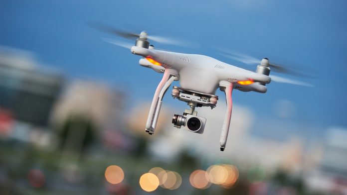
Earth observation, also known as remote sensing, is currently opening up additional data sources. With sensors installed on commercially available drones, it is obtaining further detailed environmental data – and at a spatial resolution so high that it cannot be achieved with satellite data.
“The very high resolutions in the centimetre range open up new areas of application and research questions,” said Dr Mirjana Bevanda, from the Earth Observation Research Hub at Julius-Maximilians-Universität Würzburg (JMU), a merger of the JMU Chairs of Remote Sensing and Global Urbanisation and Remote Sensing. “We are thus gaining highly relevant information for urban research, ecology, and nature conservation.”
Mapping heat islands and urban trees
To conduct a feasibility study and collect environmental data, the team imaged the Neue Universität on Sanderring and parts of Würzburg’s Ringpark with drones in 2022. Lidar, a form of three-dimensional laser scanning and thermal and multispectral sensors, were used. The latter captured five to ten wavelengths of light – significantly more than a simple photo camera.
The study aims to explore what added value the data obtained can offer for research in urban spaces, for example, to record and analyse urban structures or to map urban trees or heat islands. Professor Hannes Taubenböck, who is part of the research team, explained: “We can use this to contribute to reducing the heat island effect with targeted countermeasures, for example.”
This effect occurs when cities with many stones and asphalt surfaces heat up more than the surrounding countryside in summer. This puts a strain on people in the city, animals, and plants.
Drones also open up new options for mapping urban trees. “We could describe each tree individually, including its vertical structure, and draw conclusions about its vitality,” commented Professor Tobias Ullmann.
Expanding the study areas
The team also used drones to collect data in Canada and other study areas, documenting their changes over time. With partners, for example, from biology, it also takes a look at ecological aspects. For instance, environmental data from the JMU Forest in the Steigerwald, calcareous grasslands in Lower Franconia, or high alpine structures on the Zugspitze, are processed.
“Data acquisition with drones is very time-consuming, among other things, because of the necessary approval procedures. But the data obtained and especially its level of detail is very relevant for many research questions,” Ullmann said.
The studies focus on methodological approaches to make data acquisition and processing more efficient. In addition, the environmental data relevant to the individual research questions are to be identified. “In the long term, we want to gain new insights for Earth observation from this work, which in turn can be transferred to space-based systems,” concluded Mirjana Bevanda.