FireSENS provides the most current impact intelligence, delivered in near real-time via advanced Fire Radiative Power analysis from satellite sensing.
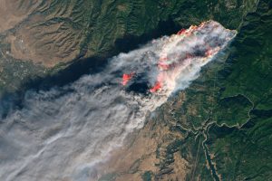
In the escalating battle against wildfires, timely and comprehensive information is paramount. Introducing FireSENS from RSS-Hydro: the revolutionary solution delivering multi-faceted wildfire impact intelligence, derived from Fire Radiative Power data obtained through advanced satellite sensing, and updated every 12 hours, with our sights set on an even more rapid six-hour update frequency starting in 2026!
Coupled with a near real-time delivery latency of under three hours, FireSENS provides the most current, actionable insights to safeguard your assets, communities, and environment.
Dynamic, real-time viewing with FireSENS
Imagine having a continuously refreshed grasp of the wildfire’s evolving consequences – its potential damage to structures, infrastructure, populations, ecosystems, and the atmosphere. FireSENS makes this a reality. By harnessing the power of cutting-edge Fire Radiative Power (FRP) data and our intelligent analysis workflow, we provide a dynamic, near real-time view of the escalating crisis, ensuring you’re always operating with the most relevant information.
Here’s the power of our near-real-time, frequently updated impact intelligence derived from FRP data merged with geospatial data layers:
- Updated damage assessment: Get a refreshed view of potential infrastructural damage every 12 hours (and soon every six!), enabling you to track the fire’s destructive path with unprecedented timeliness, informed by the latest FRP readings.
- Continuously evolving population exposure insights: Understand the shifting risks to communities with our frequent updates, allowing for proactive adjustments to evacuation plans and resource allocation, guided by near real-time FRP activity.
- Dynamic ecosystem threat monitoring: Track the expanding footprint of the fire on sensitive ecological zones with our regular intelligence updates, informing timely conservation efforts and biodiversity protection.
- Near real-time pollution awareness: Receive updated indicators of atmospheric pollution spread, derived from the atmospheric sensing of emissions, enabling swift issuance of air quality alerts and public health advisories.
Here’s how FireSENS delivers this unparalleled temporal advantage through satellite sensing:
- Consistent global monitoring: Utilising the continuous global coverage of satellite-derived FRP, we process and analyse new fire data at least twice a day, ensuring a 12-hour update cycle for our comprehensive impact layers (and moving towards a 6-hour cycle in 2026).
- Fast processing: Our sophisticated algorithms rapidly integrate the latest FRP information with our spatial impact layers, generating updated intelligence in record time.
- Near real-time delivery (<three hours): Once processed, the updated impact intelligence is delivered to your platform or simply in a data format of your choice, in under three hours, providing near real-time situational awareness.
Don’t let time be the limiting factor in your wildfire response. Equip yourself with FireSENS and gain the power of near-real-time, frequently updated impact intelligence derived from satellite data.