A research team from the Max Planck Institute for Chemistry in Mainz and Heidelberg University has used satellite monitoring to simultaneously detect the two key air pollutants carbon dioxide (CO2) and nitrogen dioxide (NO2) in emission plumes from power plants.
The new satellite monitoring system allows for tracking of industrial emissions from space with great precision and enables atmospheric processes to be analysed in detail.
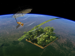
They used the German environmental satellite EnMAP (Environmental Mapping and Analysis Program), which has an unprecedented spatial resolution of just 30 metres, to detect these emissions together.
More transparent emission detection
Carbon dioxide (CO2) and nitrogen oxides (NOx) are among the most significant anthropogenic air pollutants, affecting climate, health, and air quality. Satellite monitoring is considered a key tool for independent emission monitoring.
Previously, however, they were subject to significant limitations: many sensors have spatial resolutions that are too coarse to detect isolated emissions sources such as power plants reliably.
As NO2 and CO2 are emitted together, NO2 measurements often estimate CO2 emissions based on known emission ratios. Until now, however, there has been no instrument that can detect both gases simultaneously with a high spatial resolution. The presented method closes this gap: for the first time, both gases can be measured simultaneously and with high resolution directly above the emission sources, and their ratio precisely determined.
This opens the door to more transparent and independent satellite monitoring.
High-resolution perspectives with EnMAP
Atmospheric trace gases such as CO₂ and NO₂ leave characteristic absorption patterns in sunlight, which can be detected using spectrometers.
Instruments with very high spectral resolution are typically used for satellite-based measurements. They can analyse the fine absorption structures of the gases in the reflected sunlight, but usually only achieve a spatial resolution of three to five kilometres.
In contrast, EnMAP was originally designed for remote sensing of land surfaces. It provides satellite imagery with an exceptionally high level of spatial detail of 30×30 metres, but has a comparatively low spectral resolution.
“Using the EnMAP data, we were able to determine the distribution of CO2 and NO2 in emission plumes from individual power plants, for example, from plants in Saudi Arabia and the South African Highveld region, one of the world’s largest emission hotspots,” explained Christian Borger, first author of the study.
Satellite emissions monitoring: From measurement to application
Overall, the EnMAP satellite can be used to determine CO2 and NOx emissions from individual power plants simultaneously and at high resolution. Additionally, NOx/CO2 ratios can be derived from this, which allows conclusions to be drawn about the technology, efficiency, and operating mode of the systems.
In the future, such ratios could be used to estimate CO2 emissions solely based on NO2 data.
The data also offers new insights into the chemical conversion of NO to NO2 within emission plumes. Until now, this central process in atmospheric chemistry could only be studied through complex aircraft measurement campaigns.
Using satellite data has major advantages in this context as it enables the worldwide, consistent, and comparable detection of industrial pollutant emissions.
Group leader Thomas Wagner concluded: “Our study shows how satellites with high spatial resolution can contribute to the targeted monitoring of industrial emissions in the future, in addition to large-scale missions such as the European CO2M satellite.”