Thomas Regnier, European Commission Spokesperson for tech sovereignty, defence, space, and research, discusses Europe’s Earth observation programme – Copernicus.
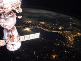
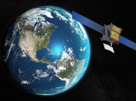
Earth observation (EO) – gathering information about the Earth’s surface, waters and atmosphere – is crucial to achieving European policy goals and delivering a better society for all. EO data can be used to inform policy and actions across a broad range of industries, including agriculture, forestry, fisheries, health, transport, tourism and more.

The EO component of the European Union’s Space programme is Copernicus, designed to look at our planet and its environment to help benefit all European citizens. The programme is managed by the European Commission and is implemented in partnership with the Member States, the European Space Agency (ESA), the European Organisation for the Exploitation of Meteorological Satellites (EUMETSAT), the European Centre for Medium-Range Weather Forecasts (ECMWF), EU Agencies and Mercator Océan, the European Environment Agency (EEA), and the Joint Research Center (JRC).
Copernicus gathers vast amounts of global data from satellites and ground-based, airborne, and seaborne measurement systems to help service providers, public authorities, and other international organisations improve European citizens’ quality of life and beyond.
We spoke to Thomas Regnier, European Commission Spokesperson for tech sovereignty, defence, space, and research, to learn more about the programme.
What is the Copernicus programme designed to achieve?
The Copernicus services are based on the European idea of providing citizens with new public services to improve the understanding of our planet, protect our environment and revitalise the economy, putting the accent on sustainability.
Who can use the Copernicus services?
The Copernicus data policy promotes access, use and sharing on a full, free, and open basis. There is no restriction on use, reproduction, and redistribution, with or without adaptation, for commercial or non-commercial purposes. Anyone can use our data and services on any grounds.
What are some of the key components of the programme?
Copernicus includes a number of web portals to access Sentinel Reference Products and/or Copernicus Services Reference Products. A main source is the Copernicus Space Data Ecosystem (CDSE) Portal. It includes visualisation tools to aid with data search and discovery, along with a variety of data processing tools. It also offers on-demand processing and access to a cloud processing environment.
In addition, for soil, marine and air pollution, the Copernicus Services for Land Monitoring, Marine Environment Monitoring and Atmosphere Monitoring provide consistent and quality-controlled information related to soil and vegetation, marine data and air pollution and health, solar energy, greenhouse gases and climate forcing, everywhere in the world.
As well as the environmental Copernicus services above, the Copernicus Emergency Management Service (CEMS) provides geospatial data and information to support all the actors involved in the management of disasters. Only authorised users – typically civil protection institutions – can request an activation, i.e., to use and benefit from the service. The CEMS’ on-demand mapping component can provide detailed information on disasters through its activation service for specific areas of interest, supporting all phases of the disaster management cycle, from preparedness to emergency response and recovery.
Can you share an example of how the Copernicus programme has helped to benefit Europe?
During the devastating wildfires in France’s Gironde region in July 2022, Copernicus’ Emergency Management Service was activated to provide rapid, high-resolution satellite mapping. These maps were essential for first responders and national authorities to assess the scale of the fires, co-ordinate firefighting efforts, and plan evacuations and recovery measures.
This rapid, accurate support exemplifies how Copernicus translates Europe’s investment in space infrastructure into direct, life-saving action on the ground.
Please note, this article will also appear in the 23rd edition of our quarterly publication.