Donna Lyndsay, Strategic Market Lead for Sustainability at Ordnance Survey, discusses how geospatial innovations are working to overcome sustainability challenges.
COP28 drove home some of the critical needs for innovative solutions to help drive transparency and trust into solving sustainability challenges and investments and how Big Data and climate monitoring will be vital in helping the transition.
Without visibility of where things are, we cannot understand corporate and government impact or how to address sustainability challenges locally.
Also, to help frame citizen support for the change needed, Sustainable Development Goals (SDGs) are now, more than ever, being seen as a useful and recognised framework to support transitions valued by citizens based on matching value sets with corporate actions.
How are sustainability challenges being overcome?
The Supply Chain Data Partnership (SCDP), of which OS is a founding member, was established at COP27 to develop and provide critical location insights for assurance of global supply chains.
One year later, the SCDP reached a major milestone in developing a proof of concept for a trusted location platform to overcome sustainability challenges. Location is the key component of the register, allowing the identification and verification of where assets such as farms, sites, and facilities are, with follow-up monitoring over time. Data and certificates associated with each verified asset owner will then sit on the new register, meeting global registry standards.
This will be accessible to buyers and investors, who can make better decisions in their procurement, reducing risk and enabling assessment of impact and opportunity. The SCDP wants to hear from businesses interested in how the register can support their SDGs.
Geospatial initiatives following COP28
This solution is now linked with an inspirational, ambitious, and influential initiative that, at a higher level, aims to enable the government, financial services, and companies to understand how to encourage, support, and verify sustainable supply chains worldwide.
Following COP28, a new coalition known as ‘The Constellation’ was announced by Rewired Earth and Bankers for Net Zero and was supported by more than 40 entities, including OS.

This new forward-leaning organisation wants to transform financial markets into the most protective force on the planet by driving transparency throughout global supply chains and sustainability investments using the SDG framework.
In the meantime, in Yorkshire, pioneering geospatial technology is helping to monitor the restoration of the nation’s peatlands. Peatlands are the largest natural carbon store on land, storing more carbon than is currently in the global atmosphere, and have a net cooling effect on climate change.
Natural England wants to prevent further loss of peatland habitats, re-wetting peatland areas and returning them to their natural state, which in turn could make a significant contribution to overcoming sustainability challenges and reaching net zero by 2050, as well as improving water quality, reducing flood risk, and supporting biodiversity.
Working with Natural England and scientists from Durham University, a new monitoring and verification service called OS VeriEarth®, built on OS’s deep expertise in objective data collection, curation and change detection, is combining satellite and ground-based data with location intelligence to create and visualise a baseline of the peatlands habitat in a target location.
The data is presented on a dashboard to enable Natural England to assess site conditions and monitor changes across a large site area. The service can record different types of vegetation species, provide reporting on vegetation cover linked to greenhouse gas emissions and monitor the water table.
There is enormous potential for this baseline and monitoring technique to be rolled out nationwide to increase and validate investment for large-scale peatland restoration projects, from carbon offsetting or carbon credits, and to help protect against greenwashing claims.
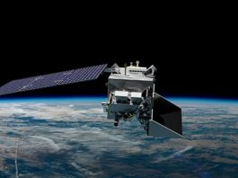
In another innovative use of Earth Observation data, CGI developed a water pollution predictive tool to detect sewage overspill events remotely from space. This falls under the umbrella of CGI’s Sustainability Exploration Environmental Data Science (SEEDS) programme, a research initiative designed to challenge the thinking and practice around sustainability challenges in partnership with academia, launched with the United Nations in 2022.
The project will utilise a newly created Artificial Intelligence (AI) model that can accurately predict the conditions most often associated with pollution events and provide a proactive approach to environmental management and nature protection in the North Devon UNESCO Biosphere Reserve.
The biosphere covers 55 square miles and is centred on Braunton Burrows, England’s largest sand dune system. The project is in its second phase, where OS tests AI outputs against real-world sensor data. If proven successful, the solution is designed to be scalable to effectively target scarce resources, helping reduce water pollution, rebalance the system back to favourable conditions, and enable nature to recover.
Humans may have created many of the problems we face. Still, we have all the creativity and technology to become the solution, enabling us to adapt to sustainability challenges and letting nature do what she does best: adapt and thrive.