Spire Global discusses why satellite constellations and a collaborative approach to satellite technology development hold the key to providing increasingly valuable insights for Earth’s protection.
In the face of increasingly extreme weather events that are disrupting lives globally, accurate Earth observation has never been more critical. Satellite technology development is facilitating a revolutionary era of space-based data and analytics, with satellites playing a pivotal role in the monitoring and mitigation of climate change and helping us to better understand our planet.
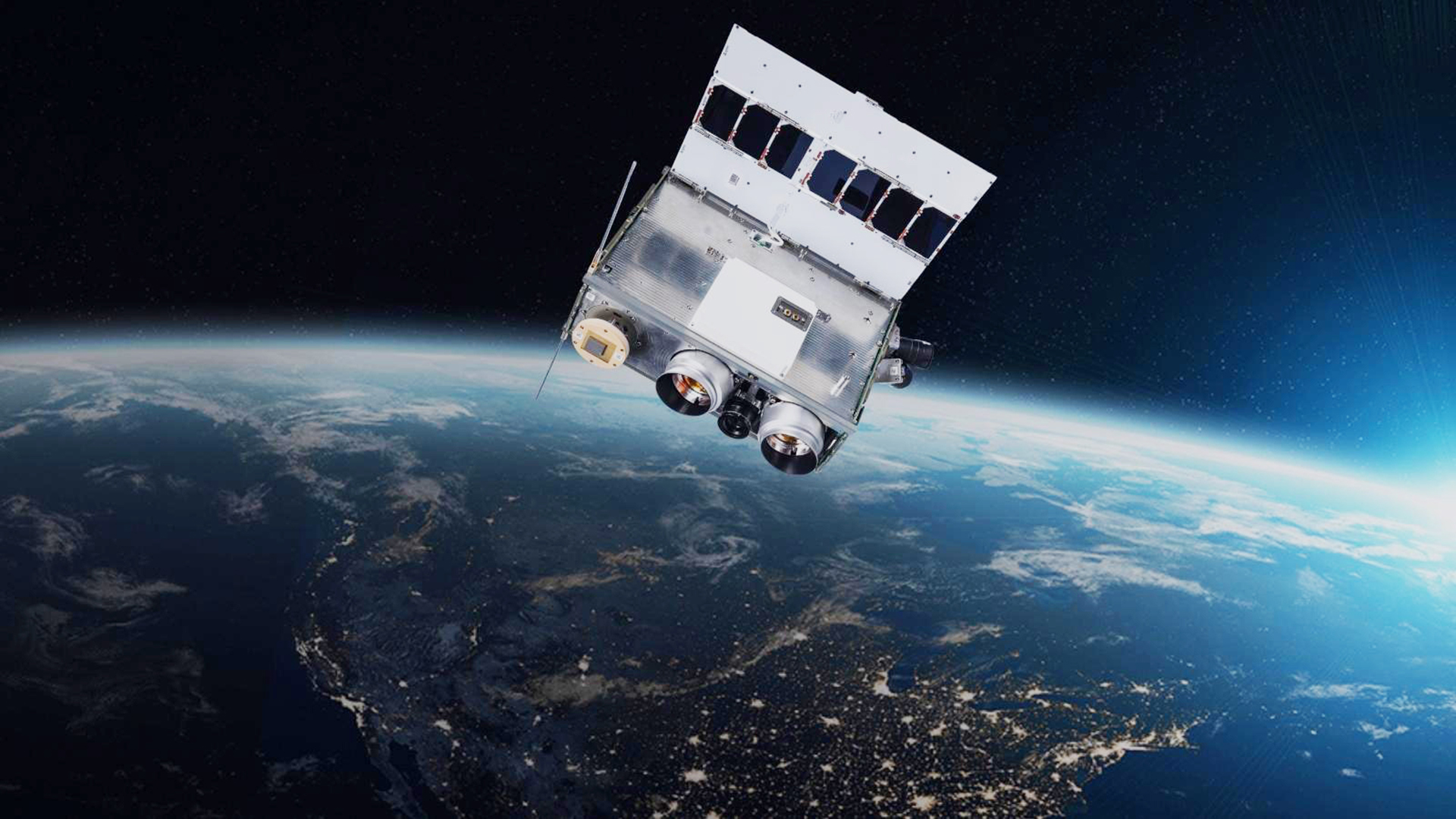
Companies like Spire Global (Spire) are leading the charge by harnessing advanced satellite technology development and developing solutions to safeguard our planet. Equipped with growing constellations and custom payloads, these satellites collect unique and essential data for climate research, disaster response planning, and resource management.
The ability to access space and satellites has evolved significantly in recent years, bringing with it greater opportunities to utilise space for improving life on Earth. According to a recent study from McKinsey, the cost performance of satellite technology has seen remarkable improvements compared to other technologies, such as cameras and mobile phones. These advancements have allowed for the deployment of smaller, more powerful satellites that offer higher resolution and near real-time data, enabling exciting possibilities for detailed Earth monitoring.
Satellites are no longer mere celestial artefacts; they have become essential tools in Earth’s protection and preservation. Organisations are now embracing the responsibility of gathering real-time data – to monitor climate patterns and terrestrial habitats – which provide valuable insights into the planet’s intricate workings. This data has far-reaching implications, influencing disaster response planning, land-use management, conservation efforts, and other critical aspects of sustainable development.
With advanced infrastructure and cutting-edge technologies, such as radio frequency sensors and high-tech optical instruments, satellite technology development offers transformative tools for actionable intelligence. Earth observation has become central to addressing global challenges like water scarcity, natural disasters, and agro-ecological research. The comprehensive datasets provided by satellites enable informed decision-making in agriculture, natural resource management, and water scarcity challenges, among others.
The power of space-based data is undeniable, and its impact is profound. By harnessing the potential of Earth observation, we take significant steps toward a more sustainable coexistence with nature. Spire’s commitment to this cause is instrumental in protecting and preserving our planet for future generations.
Spire and OroraTech join forces to revolutionise wildfire detection and monitoring
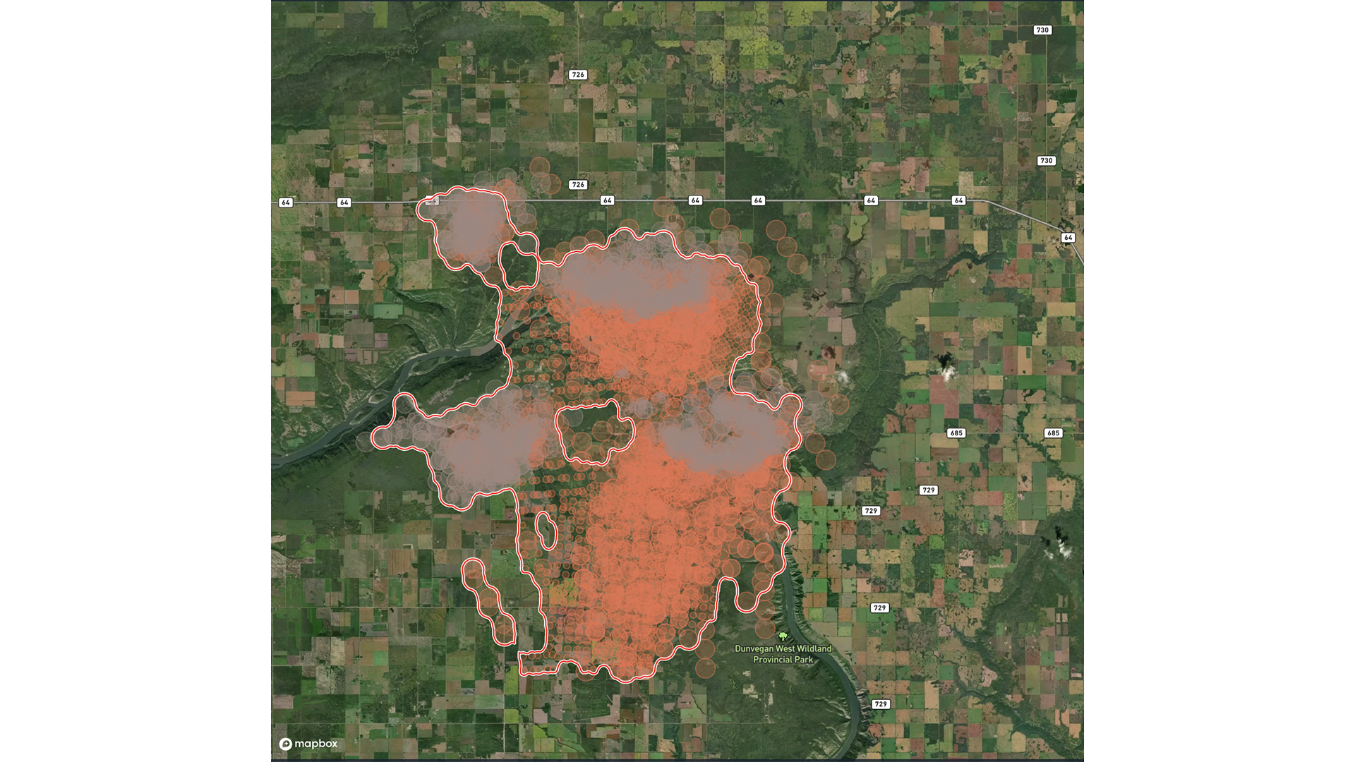
To combat the growing wildfire crisis, Spire and OroraTech, a global specialist in space-based thermal intelligence, have joined forces to revolutionise wildfire detection and monitoring using advanced satellite technology. OroraTech’s thermal-infrared cameras, hosted on Spire satellites, provide automated wildfire detection and constant global monitoring. By leveraging Spire’s satellite technology development and ground network, OroraTech is providing real-time information from space and near-instantaneous wildfire alerts.
Spire and OroraTech’s partnership began in 2021 with the launch of OroraTech’s FOREST-1 on a Spire 6U nanosatellite. Equipped with OroraTech’s thermal-infrared camera, FOREST-1 detects and monitors wildfire-prone areas using Spire’s satellite and ground station network. The sensors on FOREST-1 capture thermal-infrared data with real-time detection capability, continuous situational awareness and predictive insights to maintain control of wildfires. Recently, OroraTech launched FOREST-2 to improve the quality and coverage of satellite technology data. This launch is part of OroraTech’s larger plan to establish a constellation of eight satellites in 2024, developed and operated by Spire.
Beyond detection and monitoring, OroraTech also offers a comprehensive Thermal Intelligence suite, including real-time data, sensor network, Artificial-Intelligence-driven analytics and actionable insights. Customers across six continents and various industries are leveraging these technologies through OroraTech’s Wildfire Solution platform or specific application programming interfaces (APIs). Accessible through geospatial data platforms, thermal data offers a wide range of applications, including wildfire control (such as forest and powerline protection), insights for food security, drought mitigation, insurance, and more.
OroraTech is the first company to deliver a commercially available solution for on-orbit detection during peak burn periods. With its leading solution, OroraTech is aiding SOPFEU, the fire agency of the province of Québec, Canada, in managing over 150 ongoing fires. Once Québec fully transitions to satellite observation, the sensors will replace the province’s current use of 21 fire observation planes to cover the area multiple times per day, allowing for reduced operational effort, mitigated pilot risk, and improved situational awareness.
Spire and OroraTech are dedicated to advancing satellite technology development for the betterment of our environment. Recently, the companies were awarded a project by the Canadian Space Agency to address the need for peak burn wildfire monitoring in Canada. This country currently invests over C$1bn annually in wildfire mitigation. This initiative not only supports wildfire management; it also provides accurate carbon-emission measurements, as well as crucial information on smoke and air-quality conditions.
Together, OroraTech and Spire are pushing the boundaries of satellite technology development and wildfire monitoring, demonstrating the positive impact that can be achieved by combining expertise and resources.
Partnering for a safer and sustainable future
Later this year, Spire Global and global emissions monitoring company GHGSat are set to embark on an exciting collaboration in industrial greenhouse gas emissions monitoring with the launch of three hosted payloads on Spire’s 16U satellite buses.
The launch will expand and enhance GHGSat’s current fleet of six commercial small satellites, bolstering its satellite constellation dedicated to both high-resolution methane and carbon dioxide monitoring, and emissions tracking from carbon-intensive industries worldwide. By quantifying emissions to support local and global efforts to achieve net-zero targets, GHGSat data services play a vital role in detecting emission events accurately and participating in the fight against climate change.
Joel Spark, Spire Co-Founder and Chief Satellite Architect, commented: “Monitoring greenhouse gas emissions to help fight climate change is a perfect example of how data from space can provide insights into the biggest challenges facing humanity.
“We’re proud that GHGSat chose to leverage Spire’s proven satellite technology platform, end-to-end manufacturing facility, global ground station network and mission operations system to scale its constellation efficiently. Taking the complexity out of space so that companies like GHGSat can focus on their core mission and solve global problems is exactly why we developed our Space Services offering.”
With Spire’s Space Services offering, GHGSat can focus on monitoring while relying on Spire’s expertise in satellite technology operations and data delivery. This collaboration will enhance facility-level emissions measurements and support global efforts to combat climate change.
Satellite technology development is unleashing the power of Earth observation. Companies like Spire Global are at the forefront of this groundbreaking era, using custom payloads and a growing constellation of satellites to collect unique data vital for climate research, disaster response planning, land-use management, and resource conservation. Satellite technology has become an indispensable tool in addressing global challenges. As we harness its potential, we take significant strides towards a more sustainable and harmonious coexistence with nature, safeguarding the wellbeing of humanity and our planet for generations to come.
Please note, this article will also appear in the fifteenth edition of our quarterly publication.